 Admin
Admin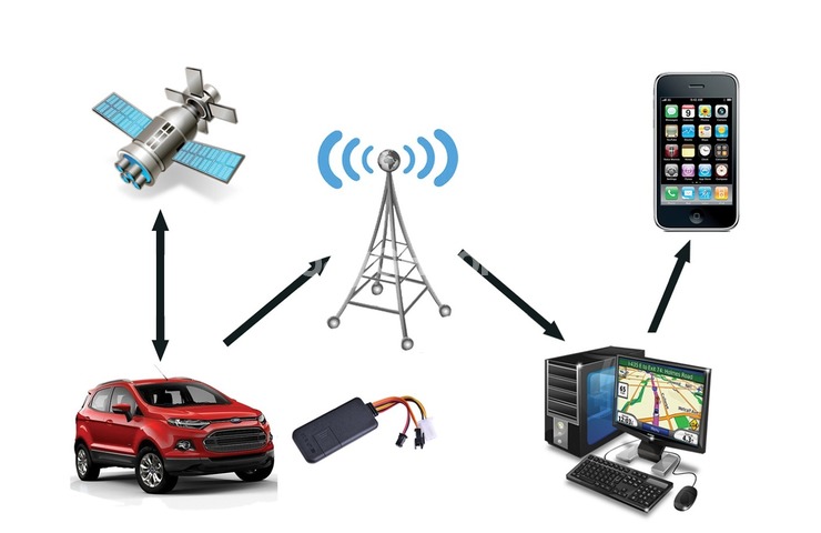
Many of us use GPS pretty much every day — getting directions with mapping apps on our phones, tracking our meal deliveries, logging our running routes — but have you ever stopped to wonder, how does GPS work?
Almost all smart phones utilize GPS technology, so let's figure out what that actually means and why having a GPS receiver and a clear view of the sky means you'll never be lost again.
What Is GPS?
When people talk about "a GPS," they usually mean a GPS receiver, but the Global Positioning System (GPS) is actually a constellation of many Earth-orbiting satellites (gps.gov/systems/gps/space/">31 in operational orbit and four that are classified as either "in reserve" or "unhealthy").
The U.S. military originally developed and implemented this satellite network as a military navigation system, then opened it up to everybody else.
Each of these 3,000- to 4,000-pound (1,361- to 1,814-kg) solar-powered satellites circles the globe at an altitude of about 12,427 miles (20,000 km), making two complete rotations every day. The orbits are arranged so that at any time, anywhere on Earth, there are at least four satellites "visible" in the sky.
How Does GPS Work?
GPS receivers work by locating four or more of these satellites, figuring out the distance to each, and using this information to deduce their own location.
This operation is based on a simple mathematical principle called trilateration. Trilateration in three-dimensional space can be a little tricky, so we'll start with an explanation of simple two-dimensional trilateration.
2D Trilateration
Imagine you are somewhere in the United States and you are totally, utterly lost; for whatever reason, you have absolutely no clue where you are. You find a friendly local and ask, "Where am I?" He says, "You are 625 miles from Boise, Idaho."
This is a nice, hard fact, but it is not particularly useful by itself. You could be anywhere on a circle around Boise that has a radius of 625 miles, like this:
You ask somebody else where you are, and she says, "You are 690 miles from Minneapolis, Minnesota." Now you're getting somewhere.
If you combine this information with the Boise information, you have two circles that intersect. You now know that you must be at one of these two intersection points, if you are 625 miles from Boise and 690 miles from Minneapolis:
If a third person tells you that you are 615 miles from Tucson, Arizona, you can eliminate one of the possibilities, because the third circle will only intersect with one of these points. You now know exactly where you are: Denver, Colorado.
This process is called 2D trilateration because the points of intersection are all located on a two-dimensional plane. When we start getting height/altitude involved — hello, third dimension — 3D trilateration comes into play.
3D Trilateration
Fundamentally, three-dimensional trilateration isn't much different from two-dimensional trilateration, but it's a little trickier to visualize. Imagine the radii from the previous examples going off in all directions. So instead of a series of circles, you get a series of spheres.
If you know you are 10 miles from satellite A in the sky, you could be anywhere on the surface of a huge, imaginary sphere with a 10-mile radius. If you also know you are 15 miles from satellite B, you can overlap the first sphere with another, larger sphere.
The spheres intersect in a perfect circle. If you know the distance to a third satellite, you get a third sphere, which intersects with this circle at two points.
Earth itself can act as a fourth "satellite" or sphere; only one of the two possible points will actually be on the surface of the planet, so you can eliminate the one in space. Receivers generally look to four or more satellites, however, to improve accuracy and provide precise altitude information.
How GPS Devices Calculate Your Location
In order to function properly, a GPS device needs to know two things:
The location of at least three satellites above you
The distance between you and each of those satellites
GPS receivers figure both of these things out by analyzing high-frequency, low-power radio signals from the satellites orbiting the Earth. Better units have multiple receivers, so they can pick up signals from several satellites simultaneously.
Radio waves are electromagnetic energy, which means they travel at the speed of light (about 186,000 miles per second, or 300,000 km per second in a vacuum). The receiver can figure out how far the GPS signal has traveled by timing how long it took the signal to arrive.
Leave A Reply
Your email address will not be published. Required fields are marked *